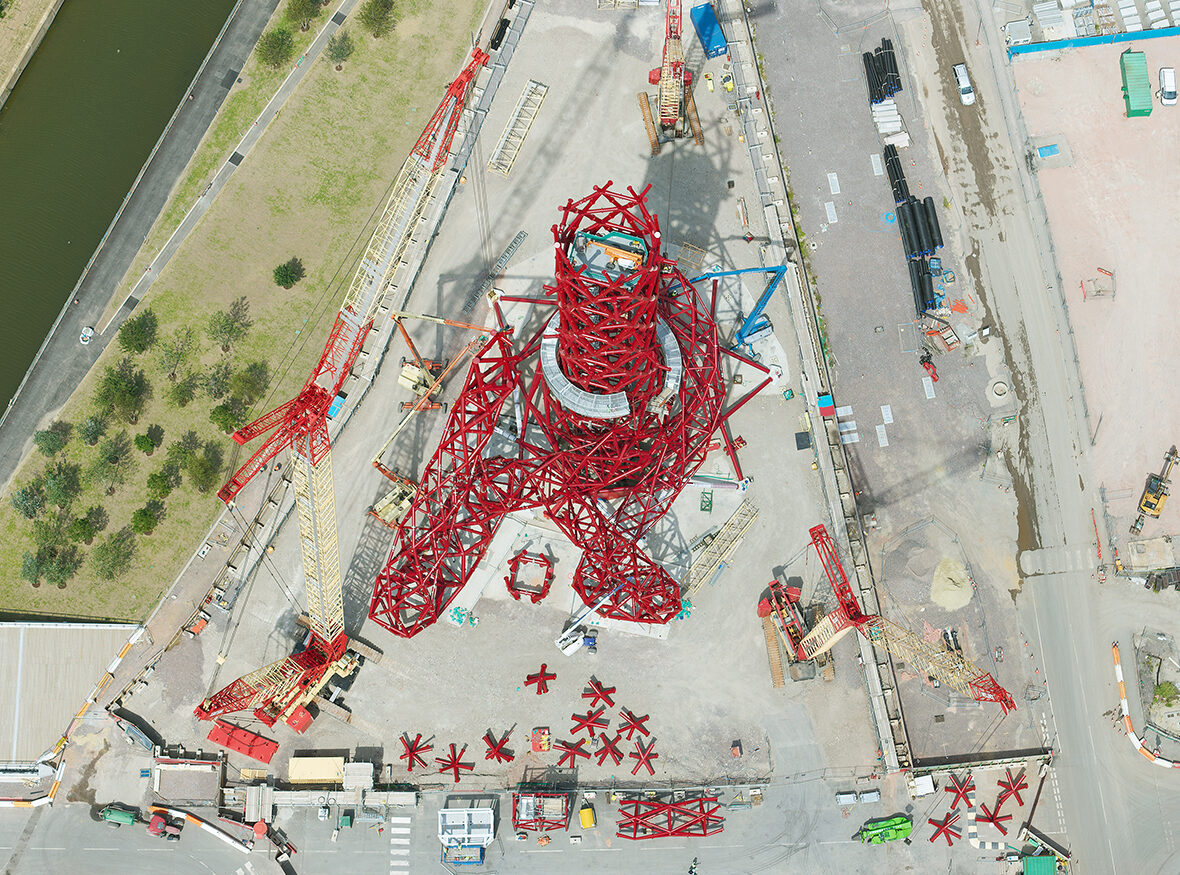
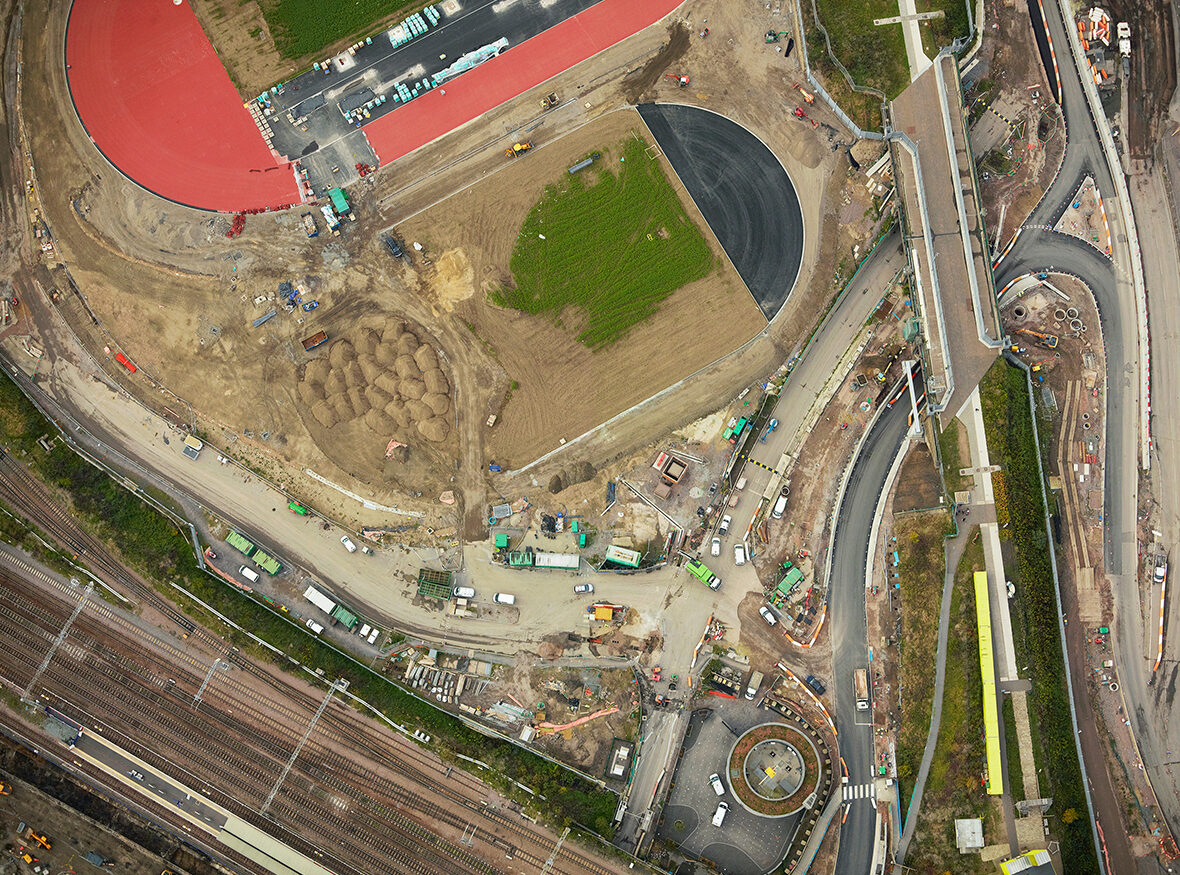
E20 12 Under Construction
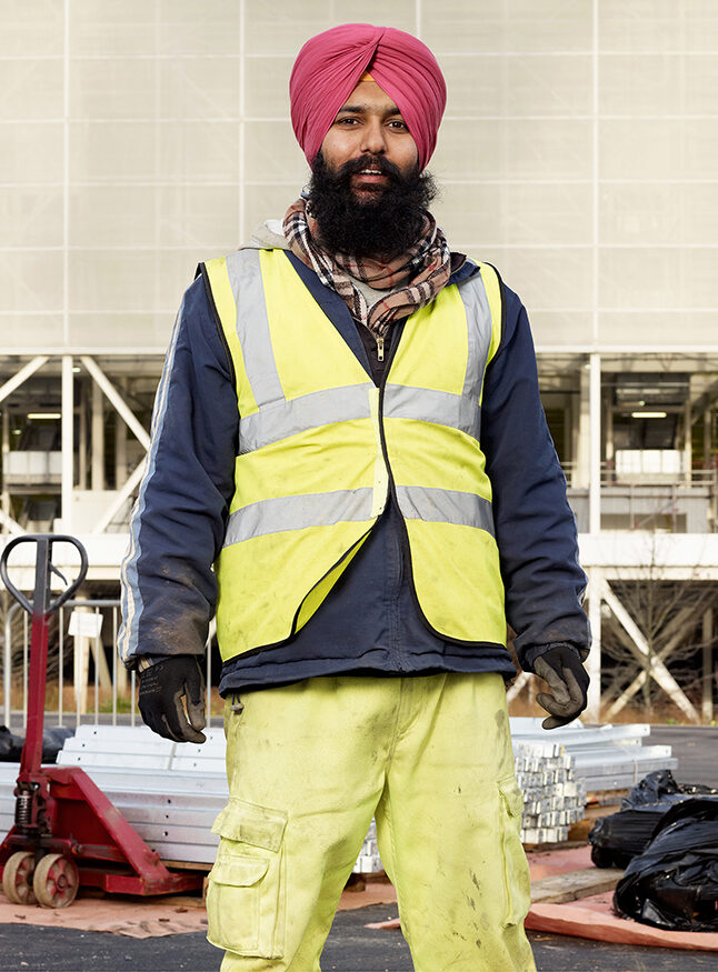
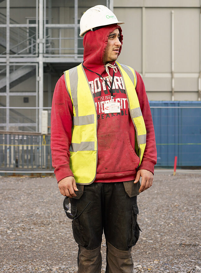
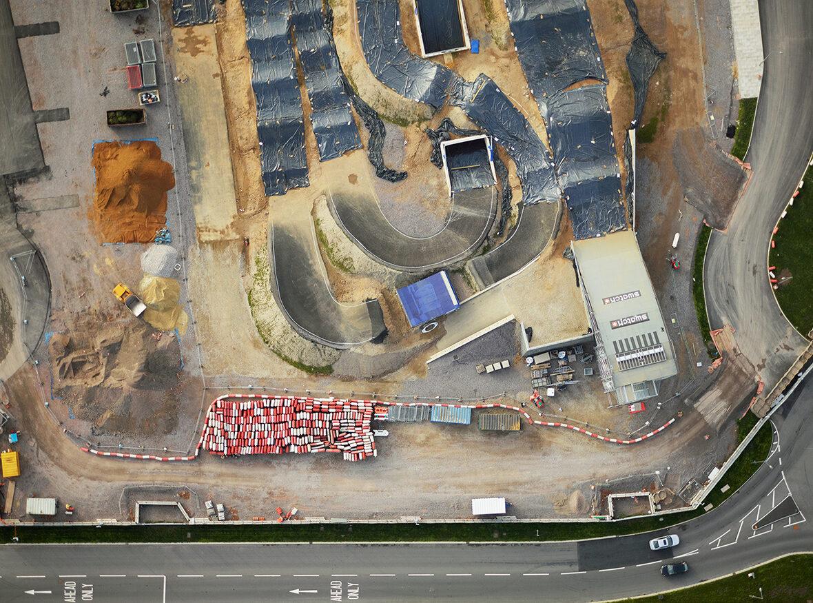
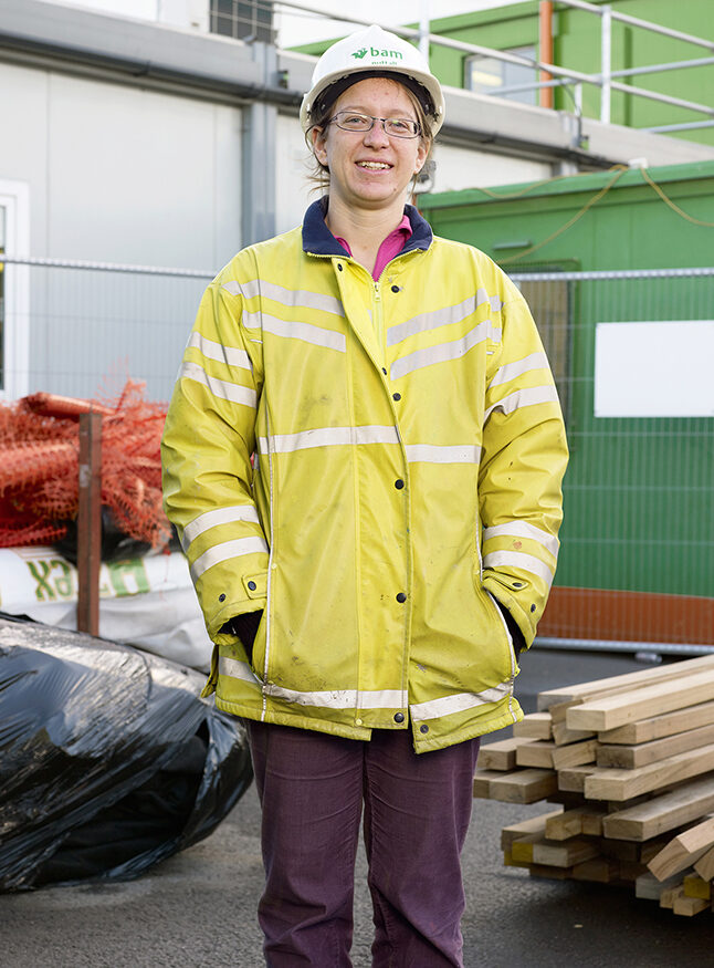
E20 12 Under Construction is a series created between 2009 and 2013, which examines the changing social and physical landscape of a formerly neglected industrial area of East London in the run up to the 2012 London Olympics.
The International Olympic Committee was founded by Pierre de Coubertin in 1894 with the belief that sport can contribute to peace and the harmonious development of humankind. And while the focus of the Olympics is mostly on the athletes and their shared endeavours to unite people and nations, the aim of this work was to show what is usually invisible: the dramatic scale of transformation to a landscape along with the unknown faces of those ordinary workers hidden from public view.
The aerial landscapes were inspired from my fascination for cartography and also Goggle Earth which was still in its infancy in 2009. The satellite image upload of London onto Google Earth was well behind what was happening on the ground, the images show a timeline and resolution which Googles satellite images could not. Conversely at ground level the portraits of workers show a snapshot demographic of Britain and London at the time, a glimpse of the wide group of cultures and nationalities involved in the construction of the site.